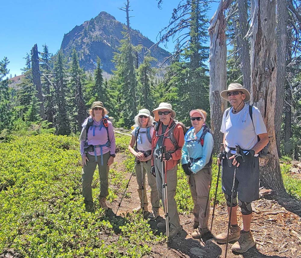
We had 5 hikers come out to Crater Lake National Park to hike Union Peak. The sky was blue and the temperature was around 70°. We started getting ready at the trailhead and were pleasantly surprised that there were very few mosquitoes. We talked with a couple who was coming back to finish the section of the PCT that goes from Highway 62 north up to McKenzie Pass (I think).
We started along the PCT and saw our first patch of snow at about 1 mile in. We passed 5 or 6 PCT through hikers and 1 day hiker. We hiked for 2.5 miles until we came to the junction for the Union Peak trail. As we hiked along we crossed a total of 5 patches of snow and had 2 downed trees.
We made our way through the forest and came to the area that had burned at least 4 years ago. The view of Mount McLoughlin was much easier to see with all the trees missing. As Union Peak came into view, we knew we were getting closer to the 36 switchbacks. Looking out on the landscape we could see the smoke cloud that was forming from the Trail Fire up by Diamond Lake and Mount Thielsen.
We ran into a younger couple that said they didn't make it to the top and were unsure of where to go so they turned around. We told them it was for the best because the last 2 times I had gone to the top, the trail had degraded and was sketchy in some parts. We started though the boulder fields and ran into another younger couple. They also did not get all the way to the top. This had us a bit concerned and we decided if the trail was in too bad of condition, we would not continue. We went through multiple switchbacks and Marilyn, Scott and Michael decided to stop while Nanci and I continued to climb the switchbacks.
We made our way through some of the steeper trail with scree by taking our time and using the rocks as hand holds. We decided we needed to take a rest in the shade before we got to the parts that we were concerned about. After a good break, we kept going. It was at this time I realized we had already made our way through the part I was most concerned with. Either someone had done some trail work and cleared where the trail had degraded or the snow had cleared it up. As we continued to the top, this was the part Nanci was concerned with so we opted to go up through the bushes instead of the more exposed trail to the right.
When we got to the top, we were surprised at how much the smoke plume had grown and were disappointed that we never saw any aerial attack on the fire. Later, I discovered some pictures on the Watch Duty app that showed planes dropping retardant on the fire.
We had a relaxing lunch and then radioed to the others we were on our way back down. We went very slow and were very deliberate with our steps and hand holds. We checked in a couple of times and connected back up with Michael. Scott and Marilyn kept going so they could be in the shade. We all gathered together and took our group photo. We then headed back to the car at a fast pace. Around 4:00 PM we saw a helicopter with a bucket fly overhead and were relieved that the fire would be getting the help from them. Shortly afterwards, we arrived at the car and had hiked 9.53 miles and gained 1,700 feet of elevation.
-
20240717_100854

-
20240717_100859

-
20240717_100920

-
20240717_105546

-
20240717_110833

-
20240717_113152

-
20240717_115016

-
20240717_115024

-
20240717_115817

-
20240717_115923

-
20240717_120008

-
20240717_120103

-
20240717_120106

-
20240717_120445

-
20240717_120702

-
20240717_120827

-
20240717_121159

-
20240717_121232

-
20240717_121321

-
20240717_121412

-
20240717_121725

-
20240717_122344

-
20240717_122935

-
20240717_123821
-
20240717_131216

-
20240717_131419

-
20240717_131707

-
20240717_131712

-
20240717_131736

-
20240717_133938

-
20240717_141528

-
20240717_142410

-
20240717_142541

-
20240717_143818

-
20240717_144433

-
Screenshot_20240717_203121_Connect

-
Screenshot_20240717_203147_Connect